Tobago Woodpecker

TOBAGO HOTELS

Tobago Pigeon Point, Mot Mot and Tobagonian

Accommodation   Activities   Beaches   Calendar   Diving   Ecology   Exploring   Fun Facts
Golf ~ Geography ~ History ~ Home ~ Hotels ~ MDDM ~ Restaurants & Nightlife
Tobago Video ~ Tobago ~ Tourism ~ Transport ~ Travel Tips ~ Vacation
Villas ~ Weddings
 ~ Whales & Dolphins

View our collection of wmv and flv videos of Tobago and Tobago Hotels

Geographical information on Tobago


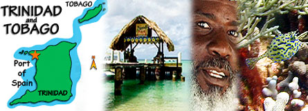
Tobago Geography Background: The islands came under British control in the 19th century; independence was granted in 1962. The country is one of the most prosperous in the Caribbean thanks largely to petroleum and natural gas production and processing. Tourism, mostly in Tobago, is targeted for expansion and is growing.

Location: Caribbean, islands between the Caribbean Sea and the North Atlantic Ocean, northeast of Venezuela

Geographic coordinates: 11 00 N, 61 00 W

Area: total: 5,128 sq km

Coastline: 362 km

Climate: tropical; rainy season (June to December) The average temperature in the summer ranges from a low of 74F to 95F with an average humidity of 85%. In the winter the average high temperature is 91F and a low of 70F with an average humidity of 80%.

The tropical climate is tempered by northeast trade winds. The dry season is from December to May, but it is hottest between June and October. The climate in Tobago is pleasant most of the year and although May, June and July can be wet at times, the differentiation between the wet and dry seasons is much less acute.

The best time to go is December-May, when it's coolest and the least rainy. Daytime temperatures will be in the 80s F/28-32 C, with nights in the 60s-70s F/15-27 C. Because of the trade winds, it rarely feels excessively hot. June-November is the rainy season, when the islands are subject to more clouds, rain and humidity. Both islands are usually outside the path of hurricanes. Take a sweater or jacket because evenings tend to cool off quite a bit.

Average yearly temperature is 78° F. From June through November expect frequent rainfall in short but strong bursts. Tobago is slightly cooler and less humid than Trinidad.

However, some months of the wet season can be very dry and some weeks of the dry season can be quite wet - it's never so easy to say ...

Required clothing: Tropical lightweights are required. Rainwear is advisable, especially for the wet season.

Terrain: mostly plains with some hills and low mountains

Elevation extremes: Caribbean Sea 0 m  El Cerro del Aripo 940 m

Natural hazards: outside the usual path of hurricanes and other tropical storms

Population: 1,163,724 (July 2002 est.)

Religions: Roman Catholic 29.4%, Hindu 23.8%, Anglican 10.9%, Muslim 5.8%, Presbyterian 3.4%, other 26.7%

Languages: English (official), Hindi, French, Spanish, Chinese

Government type: parliamentary democracy http://www.gov.tt

Capital: Scarborough (Tobago) Port-of-Spain (Trinidad)

Administrative divisions: 8 counties, 3 municipalities, and 1 ward; Arima, Caroni, Mayaro, Nariva, Port-of-Spain, Saint Andrew, Saint David, Saint George, Saint Patrick, San Fernando, Tobago, Victoria

Independence: 31 August 1962 (from UK)

National holiday: Independence Day, 31 August (1962)

Constitution: 1 August 1976

Legal system: based on English common law; judicial review of legislative acts in the Supreme Court; has not accepted compulsory ICJ jurisdiction
 

Flag description: red with a white-edged black diagonal band from the upper hoist side


TOBAGO HOTEL GUIDE


Accommodation ~ Activities ~ Beaches ~ Calendar ~ Diving ~ Ecology ~ Exploring ~ Fun Facts
Golf ~ Geography ~ History ~ Home ~ Hotels ~ MDDM ~ Restaurants & Nightlife
Tobago Video ~ Tobago ~ Tourism ~ Transport ~ Travel Tips ~ Vacation
Villas
 ~ Weddings ~ Whales & Dolphins

Visit one of our other Caribbean Island destinations
ANTIGUA   BARBADOS   CYPRUS   FLORIDA   GOSPORT   GRENADA
ST KITTS   ST LUCIA  
TOBAGO   KENYA


This website designed & hosted by
Malcolm Dent at MDDM

www.mddm.co.uk